AI
Image
geolocation
for
GeoSpy API enables blazing fast image geolocation using just pixel data. Harness the power of AI for low context data enrichment.
Python
curl
js
Java
1
2
3
4
5
6
7
8
9
10
11
12
13
14
15
16
17
18
19
20
import requests
import base64
image_path = "YOUR_IMAGE_PATH_HERE"
with open(image_path, "rb") as image_file:
encoded_string = base64.b64encode(image_file.read()).decode('utf-8')
url = f"https://dev.geospy.ai/predict?image={encoded_string}&top_k=5"
headers = {"Authorization": "Bearer YOUR_KEY_HERE"}
response = requests.post(url, headers=headers)
print(response.text)
Global Coverage
GeoSpy has been trained on billions of images from around the world. Analyzing features such as architecture, soil, and how they relate to countless geographic locations
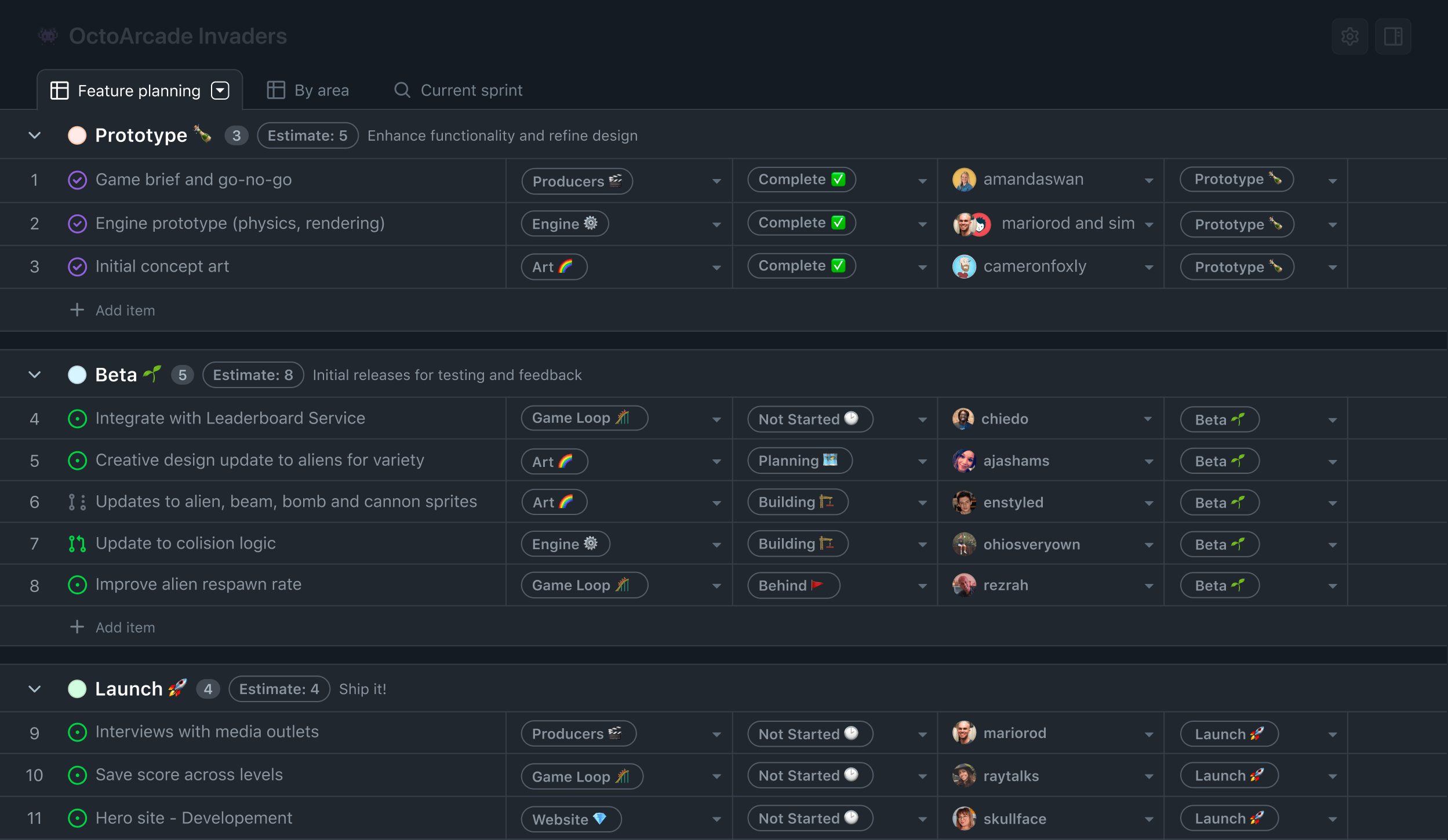
Free
For anyone looking to try the GeoSpy API
$0
/month
Billed monthly
20 images
Base GPU
Base AI model
Standard updates
Community support
Developer
For developers who want to start with essential features and resources.
$59
/month
Billed monthly
1,000 images
Base GPU
Base AI model
Standard updates
Standard support
Best Deal
Pro
For growing businesses that require higher volume and additional features.
$499
/month
Billed monthly
10,000 images
Premium GPU
Base AI model
Standard updates
Priority support
Enterprise
For organizations that need advanced features and custom solutions.
Custom
Volume pricing
Dedicated GPUs
Custom AI models
Custom integrations
Priority support
FAQ
Questions
Here you can find answers to frequently asked questions about GeoSpy AI